
Quiroga topographic map
Interactive map
Click on the map to display elevation.
About this map
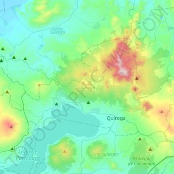
Name: Quiroga topographic map, elevation, terrain.
Location: Quiroga, Michoacán, Mexico (19.63716 -101.66869 19.77828 -101.40266)
Average elevation: 2,248 m
Minimum elevation: 1,982 m
Maximum elevation: 3,292 m
Other topographic maps
Click on a map to view its topography, its elevation and its terrain.