Geolocate

Tuzantla topographic map

Click on the map to display elevation.

About this map

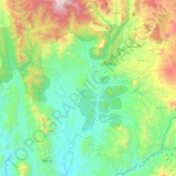
Name: Tuzantla topographic map, elevation, terrain.

Location: Tuzantla, Michoacán, Mexico (19.00567 -100.77638 19.44229 -100.44436)

Average elevation: 1,065 m

Minimum elevation: 436 m

Maximum elevation: 2,833 m

Other topographic maps

Click on a map to view its topography, its elevation and its terrain.

Tomendán

Mexico > Michoacán > Taretan

Average elevation: 1,028 m

Gear up for your next adventure:

🛶Canoe Life Vest - Safety vest for water sports
🧶550 Survival Paracord - Versatile utility cord for emergency repairs and rigging
🥾Trail Hiking Shoes - Durable shoes designed for rugged trails
🚑Survival Whistle - Signal for help across long distances in mountains
🧴Insect Repellent - Protect yourself from bugs during outdoor adventures

As an Amazon Associate, this site earns from qualifying purchases at no extra cost to you.