
Thank you for supporting this site ❤️
Make a donation
Make a donation
Gear up for your next adventure:
As an Amazon Associate, this site earns from qualifying purchases at no extra cost to you.
Jasper topographic map
Click on the map to display elevation.
Thank you for supporting this site ❤️
Make a donation
Make a donation
Gear up for your next adventure:
As an Amazon Associate, this site earns from qualifying purchases at no extra cost to you.
About this map
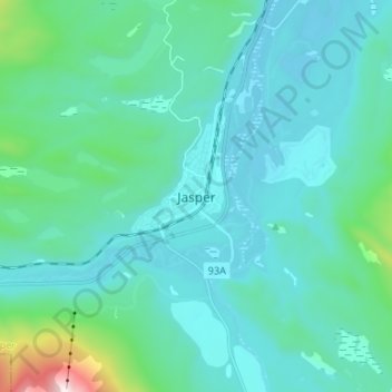
Name: Jasper topographic map, elevation, terrain.
Location: Jasper, Municipality of Jasper, Alberta, T0E 1E0, Canada (52.83523 -118.12243 52.91523 -118.04243)
Average elevation: 1,175 m
Minimum elevation: 1,017 m
Maximum elevation: 2,262 m
Alberta trails, hiking, mountain biking, running and outdoor activities
Thank you for supporting this site ❤️
Make a donation
Make a donation
Gear up for your next adventure:
As an Amazon Associate, this site earns from qualifying purchases at no extra cost to you.