
City of Port Phillip topographic map
Interactive map
Click on the map to display elevation.
About this map
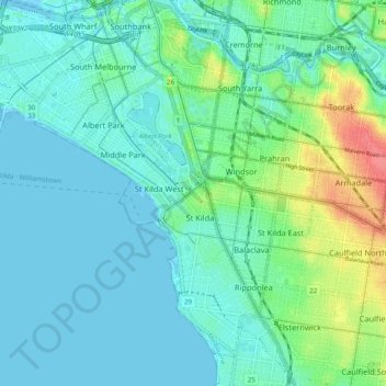
Name: City of Port Phillip topographic map, elevation, terrain.
Location: City of Port Phillip, Victoria, Australia (-37.89174 144.91247 -37.82574 145.01052)
Average elevation: 16 m
Minimum elevation: -6 m
Maximum elevation: 69 m
Other topographic maps
Click on a map to view its topography, its elevation and its terrain.
Narre Warren North Retarding Basin (Melbourne Water)
Australia > Victoria > Melbourne
Average elevation: 76 m