
Nehalem topographic map
Interactive map
Click on the map to display elevation.
Nehalem
Nehalem has an elevation of 11 feet. Lying so close to sea level, the area suffers intermittent floods. A 1996 storm caused particular damage, to local dairy farms. In November 2006, heavy rains caused flooding in Nehalem, resulting in $1 million in damage.
About this map
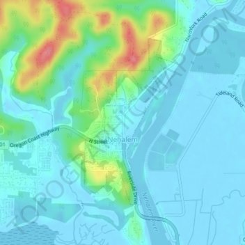
Name: Nehalem topographic map, elevation, terrain.
Location: Nehalem, Tillamook County, Oregon, 97131, United States (45.71068 -123.90044 45.72887 -123.88546)
Average elevation: 16 m
Minimum elevation: -3 m
Maximum elevation: 83 m
Other topographic maps
Click on a map to view its topography, its elevation and its terrain.