Geolocate

Headwaters (LNCT) topographic map

Click on the map to display elevation.

About this map

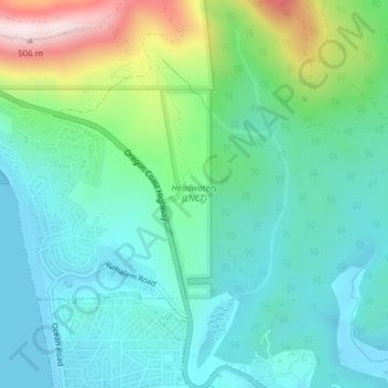
Name: Headwaters (LNCT) topographic map, elevation, terrain.

Location: Headwaters (LNCT), Tillamook County, Oregon, United States (45.72544 -123.93117 45.73997 -123.92612)

Average elevation: 118 m

Minimum elevation: 0 m

Maximum elevation: 478 m

Other topographic maps

Click on a map to view its topography, its elevation and its terrain.

Neskowin

United States > Oregon > Tillamook County

Average elevation: 48 m

Gear up for your next adventure:

🧢Outdoor Visor - Breathable visor for sunny hikes
🥾All-Terrain Hiking Boots - Versatile boots for varied hiking conditions
🧥Softshell Jacket - Windproof and breathable jacket for hiking
💡Compact LED Flashlight - Powerful and portable flashlight for outdoor use
🎒Fully Waterproof Backpack - Total protection for photography gear and electronics

As an Amazon Associate, this site earns from qualifying purchases at no extra cost to you.