
Dumayr topographic map
Interactive map
Click on the map to display elevation.
About this map
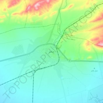
Name: Dumayr topographic map, elevation, terrain.
Average elevation: 694 m
Minimum elevation: 628 m
Maximum elevation: 896 m
Other topographic maps
Click on a map to view its topography, its elevation and its terrain.
Al-Qutayfah District
Syria > Rif Dimashq Governorate
Al-Qutayfah District, Rif Dimashq Governorate, Syria
Average elevation: 1,053 m
Markaz Rif Dimashq District
Syria > Rif Dimashq Governorate
Markaz Rif Dimashq District, Rif Dimashq Governorate, 988, Syria
Average elevation: 726 m
Al Kiswah
Syria > Rif Dimashq Governorate
Al Kiswah, Al-Kiswah Sudsitrict, Markaz Rif Dimashq District, Rif Dimashq Governorate, Syria
Average elevation: 753 m