
Shire Of Ashburton topographic map
Interactive map
Click on the map to display elevation.
About this map
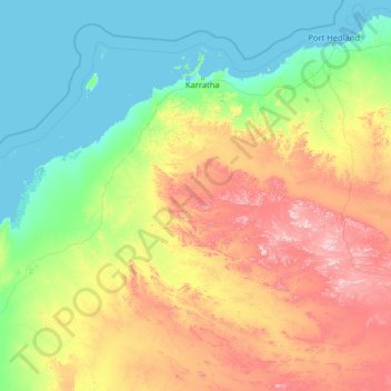
Name: Shire Of Ashburton topographic map, elevation, terrain.
Location: Shire Of Ashburton, Western Australia, Australia (-23.88787 114.27664 -20.43410 119.42682)
Average elevation: 233 m
Minimum elevation: 0 m
Maximum elevation: 1,189 m
Other topographic maps
Click on a map to view its topography, its elevation and its terrain.