
Pu'er City topographic map
Interactive map
Click on the map to display elevation.
Pu'er City
Pu'er is located in southern/southwestern Yunnan, on the lower reaches of the Mekong (known in Chinese as the Lancang), with the bordering prefectures being Yuxi to the northeast, Honghe to the east, Xishuangbanna to the south, Lincang to the northwest, and Dali and Chuxiong. It also shares borders with Vietnam (Điện Biên Province), Laos (Phongsaly Province), and Burma (Shan State), being the only prefecture in Yunnan to border all three countries. As with much of the province, mountainous terrain dominates its administrative area, covering 98.3%. Elevations range from 376 to 3,306 metres (1,234 to 10,846 ft).
About this map
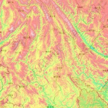
Name: Pu'er City topographic map, elevation, terrain.
Location: Pu'er City, Yunnan, 665000, China (22.02597 99.15619 24.82523 102.32353)
Average elevation: 1,479 m
Minimum elevation: 385 m
Maximum elevation: 3,457 m
Other topographic maps
Click on a map to view its topography, its elevation and its terrain.