
Güeñes topographic map
Interactive map
Click on the map to display elevation.
About this map
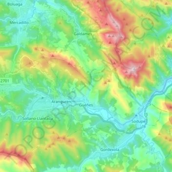
Name: Güeñes topographic map, elevation, terrain.
Location: Güeñes, Enkarterri, Biscay, Basque Country, Spain (43.18704 -3.13262 43.25384 -2.98153)
Average elevation: 285 m
Minimum elevation: 39 m
Maximum elevation: 872 m