
Disko Island topographic map
Interactive map
Click on the map to display elevation.
About this map
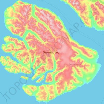
Name: Disko Island topographic map, elevation, terrain.
Location: Disko Island, Qeqertalik, Greenland (69.23089 -54.97604 70.33043 -51.84955)
Average elevation: 424 m
Minimum elevation: -3 m
Maximum elevation: 1,943 m
Other topographic maps
Click on a map to view its topography, its elevation and its terrain.