
Galt topographic map
Interactive map
Click on the map to display elevation.
About this map
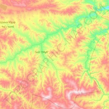
Name: Galt topographic map, elevation, terrain.
Location: Galt, Hovsgel, Mongolia (48.38708 99.57974 49.10827 100.64041)
Average elevation: 1,890 m
Minimum elevation: 1,245 m
Maximum elevation: 2,954 m
Other topographic maps
Click on a map to view its topography, its elevation and its terrain.
Gurvansaikhan
Mongolia > Hovsgel > Tsagaannuur
Gurvansaikhan, Tsagaannuur, Hovsgel, Mongolia
Average elevation: 1,594 m