
Shelburn topographic map
Interactive map
Click on the map to display elevation.
About this map
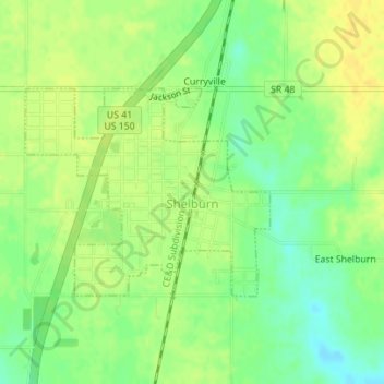
Name: Shelburn topographic map, elevation, terrain.
Location: Shelburn, Sullivan County, Indiana, United States (39.17184 -87.40879 39.18646 -87.38658)
Average elevation: 164 m
Minimum elevation: 150 m
Maximum elevation: 173 m
Other topographic maps
Click on a map to view its topography, its elevation and its terrain.
Sullivan
United States > Indiana > Sullivan County > Sullivan > Sullivan
Sullivan, Sullivan County, Indiana, 47882, United States
Average elevation: 153 m