Geolocate

Vientiane Prefecture topographic map

Interactive map

Click on the map to display elevation.

About this map

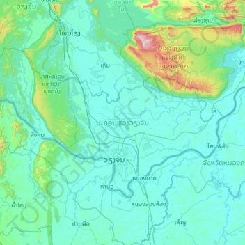
Name: Vientiane Prefecture topographic map, elevation, terrain.

Location: Vientiane Prefecture, Laos (17.80314 102.01154 18.43741 103.10281)

Average elevation: 264 m

Minimum elevation: 150 m

Maximum elevation: 1,623 m

Other topographic maps

Click on a map to view its topography, its elevation and its terrain.

Hindan

Laos > Salavan Province > Vapy District

Average elevation: 141 m

Muang Xay

Laos > Oudomxay > Muang Xay

Oudomxay Province has a moderate monsoon climate. Due to its relatively high elevation, there are more variations in temperature during the year and a colder dry season in northern Laos than in the rest of the country.

Average elevation: 928 m

Naka

Laos > Houaphanh > Naka

Average elevation: 337 m