
Ometepec topographic map
Interactive map
Click on the map to display elevation.
About this map
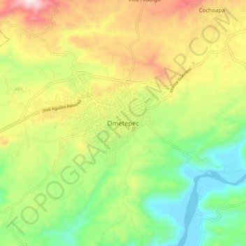
Name: Ometepec topographic map, elevation, terrain.
Location: Ometepec, Guerrero, México (16.64593 -98.44462 16.72593 -98.36462)
Average elevation: 298 m
Minimum elevation: 33 m
Maximum elevation: 668 m
Other topographic maps
Click on a map to view its topography, its elevation and its terrain.