
Whitewater topographic map
Click on the map to display elevation.
About this map
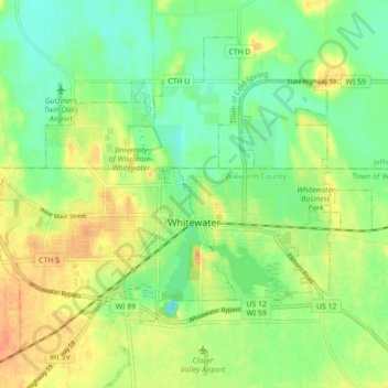
Name: Whitewater topographic map, elevation, terrain.
Location: Whitewater, Walworth County, Wisconsin, United States (42.81205 -88.77714 42.86458 -88.68877)
Average elevation: 254 m
Minimum elevation: 236 m
Maximum elevation: 274 m
Other topographic maps
Click on a map to view its topography, its elevation and its terrain.