Geolocate

Bille topographic map

Click on the map to display elevation.

About this map

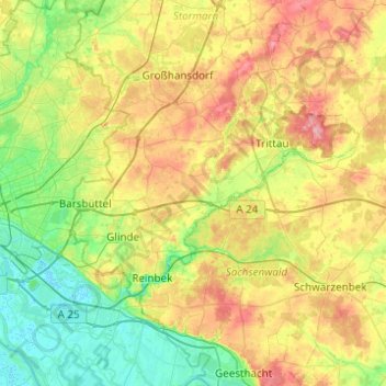
Name: Bille topographic map, elevation, terrain.

Location: Bille, Stormarn, Schleswig-Holstein, Germany (53.48950 10.02339 53.65749 10.51570)

Average elevation: 38 m

Minimum elevation: -2 m

Maximum elevation: 100 m

Gear up for your next adventure:

🧊Insulated Water Bottle - Keeps drinks cold in summer and prevents freezing in winter
🦯Trekking Poles - Reduced impact on joints for steep topographic climbs
🕶️Polarized Sunglasses - Reduces glare from snow and water at high elevations
🧦Crew Hiking Socks - Comfortable socks for long-distance hikes
🏃Hydration Running Vest - Carry water and maps close to your body for speed

As an Amazon Associate, this site earns from qualifying purchases at no extra cost to you.