Geolocate

Beloit topographic map

Click on the map to display elevation.

About this map

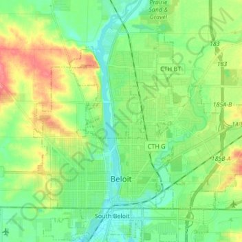
Name: Beloit topographic map, elevation, terrain.

Location: Beloit, Rock County, Wisconsin, United States (42.49577 -89.08095 42.56861 -88.94507)

Average elevation: 246 m

Minimum elevation: 224 m

Maximum elevation: 287 m

Gear up for your next adventure:

🧥Softshell Hiking Jacket - The perfect balance of wind protection and breathability
🚲Handlebar Phone Mount - View topographic-map.com live while cycling
🧥Thermal Layer - Insulating layer for cold outdoor conditions
🎒Hiking Backpack - Lightweight and ergonomic backpacks for day hikes or multi-day treks
🧤Rechargeable Heated Gloves - Extreme warmth for Canadian winter expeditions

As an Amazon Associate, this site earns from qualifying purchases at no extra cost to you.