Geolocate

Rajapur topographic map

Click on the map to display elevation.

About this map

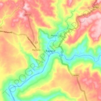
Name: Rajapur topographic map, elevation, terrain.

Location: Rajapur, Rajapur Taluka, Ratnagiri, Maharashtra, 416702, India (16.61332 73.47485 16.69332 73.55485)

Average elevation: 134 m

Minimum elevation: 0 m

Maximum elevation: 261 m

Gear up for your next adventure:

🌡️Emergency Mylar Blankets - Compact thermal protection for unexpected nights outdoors
🥾Trail Hiking Socks - Comfortable socks to prevent blisters and fatigue
🧦Hiking Socks - Moisture-wicking and comfortable socks for long hikes
❄️Traction Ice Cleats - Slip-on spikes for icy trails and winter hiking
🗺️Topographic Maps - Detailed maps to explore trails, mountains, and wilderness areas

As an Amazon Associate, this site earns from qualifying purchases at no extra cost to you.