Geolocate

Alagao topographic map

Click on the map to display elevation.

About this map

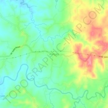
Name: Alagao topographic map, elevation, terrain.

Location: Alagao, San Ildefonso, Bulacan, Central Luzon, Philippines (15.03094 121.02500 15.07094 121.06500)

Average elevation: 77 m

Minimum elevation: 39 m

Maximum elevation: 144 m

Other topographic maps

Click on a map to view its topography, its elevation and its terrain.

Akle

Philippines > Bulacan > San Ildefonso

Average elevation: 128 m

Palapala

Philippines > Bulacan > San Ildefonso

Average elevation: 34 m

Gear up for your next adventure:

🧥Waterproof Jacket - Lightweight rain jackets for hiking and outdoor activities
🥾Waterproof Trail Shoes - Shoes designed to handle wet terrain
👟Trail Running Shoes - Agile footwear for fast-paced topographic exploration
Camping Groundsheet - Protect your tent from moisture and dirt
🔭Compact Monocular - One-handed bird watching and trail spotting

As an Amazon Associate, this site earns from qualifying purchases at no extra cost to you.