
Thank you for supporting this site ❤️
Make a donation
Make a donation
Gear up for your next adventure:
As an Amazon Associate, this site earns from qualifying purchases at no extra cost to you.
Rhosllanerchrugog topographic map
Click on the map to display elevation.
Thank you for supporting this site ❤️
Make a donation
Make a donation
Gear up for your next adventure:
As an Amazon Associate, this site earns from qualifying purchases at no extra cost to you.
About this map
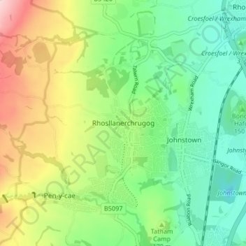
Name: Rhosllanerchrugog topographic map, elevation, terrain.
Location: Rhosllanerchrugog, Wrexham, Wales, LL14 2LH, United Kingdom (52.99273 -3.07942 53.03273 -3.03942)
Average elevation: 172 m
Minimum elevation: 79 m
Maximum elevation: 340 m
Thank you for supporting this site ❤️
Make a donation
Make a donation
Gear up for your next adventure:
As an Amazon Associate, this site earns from qualifying purchases at no extra cost to you.