Geolocate

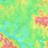
Pommier topographic map

Click on the map to display elevation.

About this map

Name: Pommier topographic map, elevation, terrain.

Location: Pommier, Saint-Dizier-Leyrenne, Saint-Dizier-Masbaraud, Guéret, Creuse, Nouvelle-Aquitaine, France métropolitaine, 23400, France (46.00586 1.71982 46.04586 1.75982)

Average elevation: 467 m

Minimum elevation: 386 m

Maximum elevation: 621 m

Other topographic maps

Click on a map to view its topography, its elevation and its terrain.
Gear up for your next adventure:

🥾Waterproof Hiking Boots - Essential footwear for rugged terrain and wet Canadian trails
⛺Backpacking Tent - Lightweight tent for long-distance hiking trips
👟Leg Gaiters - Keep debris, mud, and snow out of your boots
🧥Waterproof Hiking Jacket - Protect yourself from rain and wind while hiking
🧤Insulated Winter Gloves - Heavy-duty protection for sub-zero Canadian adventures

As an Amazon Associate, this site earns from qualifying purchases at no extra cost to you.