
Thank you for supporting this site ❤️
Make a donation
Make a donation
Gear up for your next adventure:
As an Amazon Associate, this site earns from qualifying purchases at no extra cost to you.
Ngamring topographic map
Click on the map to display elevation.
Thank you for supporting this site ❤️
Make a donation
Make a donation
Gear up for your next adventure:
As an Amazon Associate, this site earns from qualifying purchases at no extra cost to you.
About this map
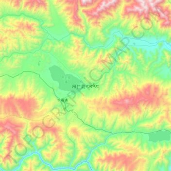
Name: Ngamring topographic map, elevation, terrain.
Location: Ngamring, Kagar, Ngamring County, Shigatse, Tibet, China (29.13902 87.07251 29.45902 87.39251)
Average elevation: 4,636 m
Minimum elevation: 4,081 m
Maximum elevation: 5,666 m
Thank you for supporting this site ❤️
Make a donation
Make a donation
Gear up for your next adventure:
As an Amazon Associate, this site earns from qualifying purchases at no extra cost to you.