
Thank you for supporting this site ❤️
Make a donation
Make a donation
Gear up for your next adventure:
As an Amazon Associate, this site earns from qualifying purchases at no extra cost to you.
Patsch topographic map
Click on the map to display elevation.
Thank you for supporting this site ❤️
Make a donation
Make a donation
Gear up for your next adventure:
As an Amazon Associate, this site earns from qualifying purchases at no extra cost to you.
About this map
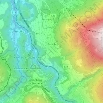
Name: Patsch topographic map, elevation, terrain.
Location: Patsch, Bezirk Innsbruck-Land, Tirolo, 6082, Austria (47.18058 11.39456 47.22136 11.46840)
Average elevation: 1,072 m
Minimum elevation: 653 m
Maximum elevation: 1,996 m
Thank you for supporting this site ❤️
Make a donation
Make a donation
Gear up for your next adventure:
As an Amazon Associate, this site earns from qualifying purchases at no extra cost to you.