Geolocate

Nimaima topographic map

Click on the map to display elevation.

About this map

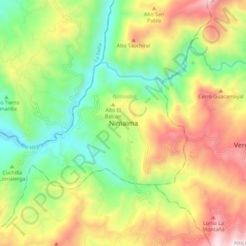
Name: Nimaima topographic map, elevation, terrain.

Location: Nimaima, Gualivá, Cundinamarca, Colombia (5.08539 -74.42535 5.16539 -74.34535)

Average elevation: 1,133 m

Minimum elevation: 665 m

Maximum elevation: 1,767 m

Gear up for your next adventure:

🔦UV Flashlight - Detect minerals or specific insects in the dark
🛰️Satellite Messenger - Emergency communication for areas with no cell service
🥾Trekking Boots - Durable boots for long-distance trekking
🥾Trail Hiking Socks - Comfortable socks to prevent blisters and fatigue
🧥Waterproof Pants - Keep dry during rainy hiking conditions

As an Amazon Associate, this site earns from qualifying purchases at no extra cost to you.