
Thank you for supporting this site ❤️
Make a donation
Make a donation
Gear up for your next adventure:
As an Amazon Associate, this site earns from qualifying purchases at no extra cost to you.
Peterhead topographic map
Click on the map to display elevation.
Thank you for supporting this site ❤️
Make a donation
Make a donation
Gear up for your next adventure:
As an Amazon Associate, this site earns from qualifying purchases at no extra cost to you.
About this map
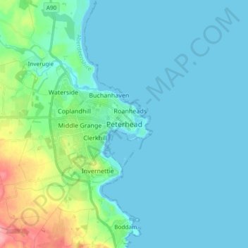
Name: Peterhead topographic map, elevation, terrain.
Location: Peterhead, Aberdeenshire, Scotland, AB42 1ZP, United Kingdom (57.46529 -1.82132 57.54529 -1.74132)
Average elevation: 17 m
Minimum elevation: 0 m
Maximum elevation: 105 m
Thank you for supporting this site ❤️
Make a donation
Make a donation
Gear up for your next adventure:
As an Amazon Associate, this site earns from qualifying purchases at no extra cost to you.