
Thank you for supporting this site ❤️
Make a donation
Make a donation
Gear up for your next adventure:
As an Amazon Associate, this site earns from qualifying purchases at no extra cost to you.
`Awdah topographic map
Click on the map to display elevation.
Thank you for supporting this site ❤️
Make a donation
Make a donation
Gear up for your next adventure:
As an Amazon Associate, this site earns from qualifying purchases at no extra cost to you.
About this map
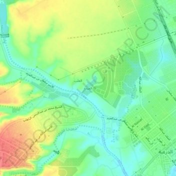
Name: `Awdah topographic map, elevation, terrain.
Location: `Awdah, Ad Dir`iyah, Ad Diriyah, Riyadh Region, Saudi Arabia (24.74271 46.53232 24.78271 46.57232)
Average elevation: 676 m
Minimum elevation: 650 m
Maximum elevation: 713 m
Thank you for supporting this site ❤️
Make a donation
Make a donation
Gear up for your next adventure:
As an Amazon Associate, this site earns from qualifying purchases at no extra cost to you.