
Thank you for supporting this site ❤️
Make a donation
Make a donation
Gear up for your next adventure:
As an Amazon Associate, this site earns from qualifying purchases at no extra cost to you.
Föritztal topographic map
Click on the map to display elevation.
Thank you for supporting this site ❤️
Make a donation
Make a donation
Gear up for your next adventure:
As an Amazon Associate, this site earns from qualifying purchases at no extra cost to you.
About this map
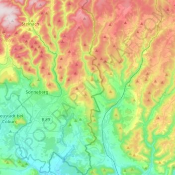
Name: Föritztal topographic map, elevation, terrain.
Location: Föritztal, Landkreis Sonneberg, Thüringen, 96524, Deutschland (50.26677 11.13050 50.45779 11.28414)
Average elevation: 501 m
Minimum elevation: 302 m
Maximum elevation: 837 m
Thank you for supporting this site ❤️
Make a donation
Make a donation
Gear up for your next adventure:
As an Amazon Associate, this site earns from qualifying purchases at no extra cost to you.