Geolocate

Gorafe topographic map

Click on the map to display elevation.

About this map
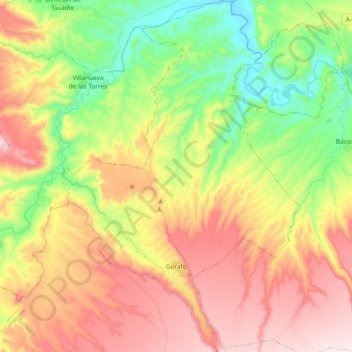
Name: Gorafe topographic map, elevation, terrain.

Location: Gorafe, Comarca de Guadix, Granada, Andalusia, 18890, Spain (37.44342 -3.10394 37.59087 -2.97793)

Average elevation: 816 m

Minimum elevation: 543 m

Maximum elevation: 1,124 m

Gear up for your next adventure:

⛺Bushcraft Tarp - Versatile emergency shelter or gear protection
🧭Orienteering Kit - Tools for map reading and navigation in the wild
⛺Lightweight Backpacking Tent - Compact tent for efficient hiking trips
🥾Hiking Shorts - Breathable shorts suitable for summer hikes
🥾Trail Running Shoes - Lightweight and durable shoes for trail running

As an Amazon Associate, this site earns from qualifying purchases at no extra cost to you.