Geolocate

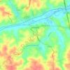
Shacktown Falls topographic map

Click on the map to display elevation.

About this map

Name: Shacktown Falls topographic map, elevation, terrain.

Location: Shacktown Falls, Yadkin County, North Carolina, United States (36.12416 -80.59323 36.12426 -80.59313)

Average elevation: 259 m

Minimum elevation: 223 m

Maximum elevation: 288 m

Other topographic maps

Click on a map to view its topography, its elevation and its terrain.

East Bend

United States > North Carolina > Yadkin County

Average elevation: 307 m

Gear up for your next adventure:

🥾Mountaineering Boots - Supportive boots for climbing and high-altitude hiking
⛺Bushcraft Tarp - Versatile emergency shelter or gear protection
🥾Lightweight Hiking Boots - Boots for comfort and mobility on long hikes
🛶Canoe Life Vest - Safety vest for water sports
🧴Bear Spray Holster - Quick-access carry for essential Canadian wilderness safety

As an Amazon Associate, this site earns from qualifying purchases at no extra cost to you.