Geolocate

Campo topographic map

Click on the map to display elevation.

About this map

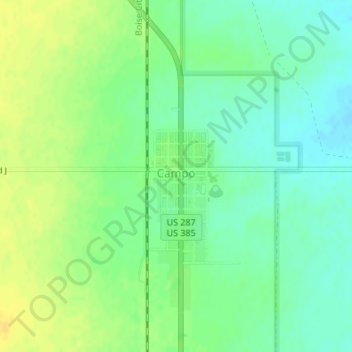
Name: Campo topographic map, elevation, terrain.

Location: Campo, Baca County, Colorado, United States (37.10121 -102.58169 37.10835 -102.57526)

Average elevation: 1,324 m

Minimum elevation: 1,313 m

Maximum elevation: 1,336 m

Other topographic maps

Click on a map to view its topography, its elevation and its terrain.

Springfield

United States > Colorado > Baca County

Average elevation: 1,331 m

Walsh

United States > Colorado > Baca County

Average elevation: 1,204 m

Pritchett

United States > Colorado > Baca County

Average elevation: 1,466 m

Vilas

United States > Colorado > Baca County

Average elevation: 1,268 m

Two Buttes

United States > Colorado > Baca County

Average elevation: 1,252 m

Gear up for your next adventure:

🧢Hiking Hat - Sun-protective and breathable hats for long treks
💡Compact LED Flashlight - Powerful and portable flashlight for outdoor use
📷Outdoor Action Camera - Capture high-elevation views and rugged adventures
🔦UV Flashlight - Detect minerals or specific insects in the dark
🛁Quick-Dry Microfiber Towel - Space-saving towel that dries rapidly on the move

As an Amazon Associate, this site earns from qualifying purchases at no extra cost to you.