
Thank you for supporting this site ❤️
Make a donation
Make a donation
Gear up for your next adventure:
As an Amazon Associate, this site earns from qualifying purchases at no extra cost to you.
Leombach topographic map
Click on the map to display elevation.
Thank you for supporting this site ❤️
Make a donation
Make a donation
Gear up for your next adventure:
As an Amazon Associate, this site earns from qualifying purchases at no extra cost to you.
About this map
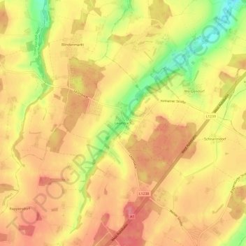
Name: Leombach topographic map, elevation, terrain.
Location: Leombach, Sipbachzell, Bezirk Wels-Land, 4621, Austria (48.10344 14.07288 48.14344 14.11288)
Average elevation: 378 m
Minimum elevation: 325 m
Maximum elevation: 405 m
Thank you for supporting this site ❤️
Make a donation
Make a donation
Gear up for your next adventure:
As an Amazon Associate, this site earns from qualifying purchases at no extra cost to you.