Geolocate

Xiaba topographic map

Click on the map to display elevation.

About this map

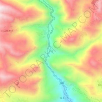
Name: Xiaba topographic map, elevation, terrain.

Location: Xiaba, Li County, Longnan, Gansu, China (33.88358 104.81864 33.92358 104.85864)

Average elevation: 1,927 m

Minimum elevation: 1,474 m

Maximum elevation: 2,306 m

Gear up for your next adventure:

🥾Light Trekking Boots - Supportive boots for multi-day treks
🥾Trail Hiking Boots - Supportive boots for rough trails
🕶️Polarized Sunglasses - Reduces glare from snow and water at high elevations
🚲Handlebar Phone Mount - View topographic-map.com live while cycling
🥾Hiking Boots - Sturdy boots providing ankle support and traction on rugged trails

As an Amazon Associate, this site earns from qualifying purchases at no extra cost to you.