
Port topographic map
Click on the map to display elevation.
About this map
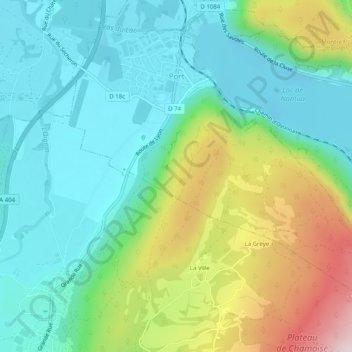
Name: Port topographic map, elevation, terrain.
Average elevation: 606 m
Minimum elevation: 463 m
Maximum elevation: 946 m
Other topographic maps
Click on a map to view its topography, its elevation and its terrain.
Les Huguets
France > Auvergne-Rhône-Alpes > Ain > Saint-Didier-sur-Chalaronne
Average elevation: 184 m