
Nanyuki topographic map
Interactive map
Click on the map to display elevation.
About this map
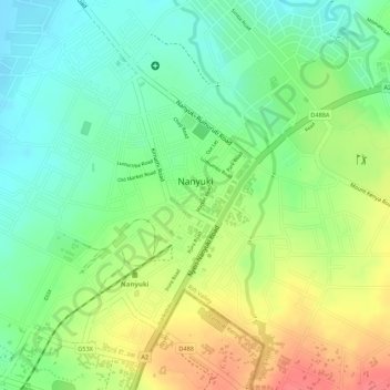
Name: Nanyuki topographic map, elevation, terrain.
Location: Nanyuki, Laikipia East, Laikipia County, Rift Valley, Kenia (-0.00058 37.06032 0.02668 37.08006)
Average elevation: 1,937 m
Minimum elevation: 1,905 m
Maximum elevation: 1,976 m
Nanyuki ist die Hauptstadt des Laikipia Countys in Kenia. Sie hat schätzungsweise 50.000 Einwohner und liegt auf einer Höhe von 1986 Metern am Fuße des Mount Kenya am Äquator. Nanyuki wurde 1907 von britischen Siedlern gegründet und seit 1974 ist dort die Hauptbasis der kenianischen Luftwaffe.