
Thank you for supporting this site ❤️
Make a donation
Make a donation
Gear up for your next adventure:
As an Amazon Associate, this site earns from qualifying purchases at no extra cost to you.
Cojitambo topographic map
Click on the map to display elevation.
Thank you for supporting this site ❤️
Make a donation
Make a donation
Gear up for your next adventure:
As an Amazon Associate, this site earns from qualifying purchases at no extra cost to you.
About this map
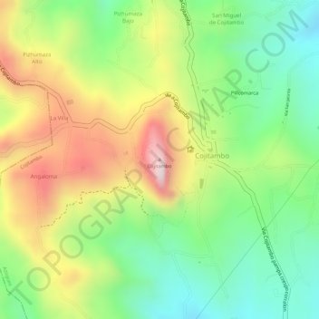
Name: Cojitambo topographic map, elevation, terrain.
Location: Cojitambo, Azogues, Cañar, 030101, Ecuador (-2.75946 -78.88872 -2.75936 -78.88862)
Average elevation: 2,827 m
Minimum elevation: 2,639 m
Maximum elevation: 3,056 m
Thank you for supporting this site ❤️
Make a donation
Make a donation
Gear up for your next adventure:
As an Amazon Associate, this site earns from qualifying purchases at no extra cost to you.