
Beveren topographic map
Interactive map
Click on the map to display elevation.
About this map
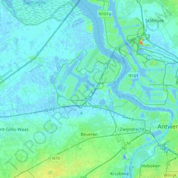
Name: Beveren topographic map, elevation, terrain.
Location: Beveren, East Flanders, Flanders, Belgium (51.16642 4.15249 51.35397 4.32155)
Average elevation: 5 m
Minimum elevation: -16 m
Maximum elevation: 39 m