
Thank you for supporting this site ❤️
Make a donation
Make a donation
Gear up for your next adventure:
As an Amazon Associate, this site earns from qualifying purchases at no extra cost to you.
Picoitos topographic map
Click on the map to display elevation.
Thank you for supporting this site ❤️
Make a donation
Make a donation
Gear up for your next adventure:
As an Amazon Associate, this site earns from qualifying purchases at no extra cost to you.
About this map
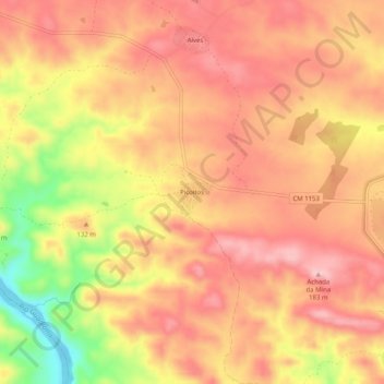
Name: Picoitos topographic map, elevation, terrain.
Location: Picoitos, Santana de Cambas, Mértola, Beja, 7750-410, Portugal (37.56959 -7.58535 37.60959 -7.54535)
Average elevation: 119 m
Minimum elevation: 2 m
Maximum elevation: 178 m
Thank you for supporting this site ❤️
Make a donation
Make a donation
Gear up for your next adventure:
As an Amazon Associate, this site earns from qualifying purchases at no extra cost to you.