Geolocate

Swearingen topographic map

Click on the map to display elevation.

About this map

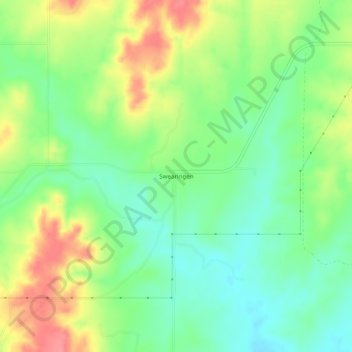
Name: Swearingen topographic map, elevation, terrain.

Location: Swearingen, Collingsworth County, Texas, United States (34.77033 -100.40179 34.81033 -100.36179)

Average elevation: 617 m

Minimum elevation: 585 m

Maximum elevation: 662 m

Gear up for your next adventure:

🔪Outdoor Multitool - Versatile tool for repairs and food prep in the wild
🧥Fleece Jacket - Warm and lightweight jacket for layering
🧥Packable Rain Jacket - Breathable waterproof layer for unpredictable weather
🔦LED Headlamp - Hands-free lighting for early morning starts or late finishes
🥾Mountain Hiking Shoes - Shoes with superior grip for mountainous terrain

As an Amazon Associate, this site earns from qualifying purchases at no extra cost to you.