Geolocate

Nakuri topographic map

Click on the map to display elevation.

About this map

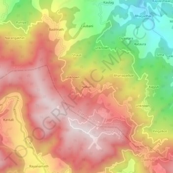
Name: Nakuri topographic map, elevation, terrain.

Location: Nakuri, Garud, Bageshwar District, Uttarakhand, 263639, India (29.83840 79.56790 29.87840 79.60790)

Average elevation: 1,631 m

Minimum elevation: 1,201 m

Maximum elevation: 1,935 m

Other topographic maps

Click on a map to view its topography, its elevation and its terrain.

Lahor Nadi

India > Uttarakhand > Garud > Urakhuli

Average elevation: 1,464 m

Gear up for your next adventure:

🦶Hiking Shoe Insoles - Added support for high arches and long days on feet
🥾Trail Running Boots - Durable shoes designed for trail running
🥤Collapsible Travel Cup - Saves space and weight in your mess kit
💡Compact LED Flashlight - Powerful and portable flashlight for outdoor use
🕯️Camping Lantern - Illuminates your entire campsite with high-efficiency LEDs

As an Amazon Associate, this site earns from qualifying purchases at no extra cost to you.