
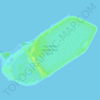
Hart-Miller Island topographic map
Interactive map
Click on the map to display elevation.
About this map
Name: Hart-Miller Island topographic map, elevation, terrain.
Location: Hart-Miller Island, Towson, Baltimore County, Maryland, USA (39.23777 -76.38660 39.26174 -76.34401)
Average elevation: 2 m
Minimum elevation: -2 m
Maximum elevation: 13 m
Other topographic maps
Click on a map to view its topography, its elevation and its terrain.
Loch Raven Reservoir
Loch Raven Reservoir, Dulaney Valley Road, Towson, Baltimore County, Maryland, 21093, USA
Average elevation: 113 m
Mingo Branch
United States > Maryland > Towson
Mingo Branch, Baltimore County, Maryland, 21120, United States
Average elevation: 173 m
The Bunker
The Bunker, Towson, Baltimore County, Maryland, USA
Average elevation: 152 m
Cromwell Valley Park
Cromwell Valley Park, Satyr Hill Estates, Towson, Baltimore County, Maryland, USA
Average elevation: 106 m