
Thank you for supporting this site ❤️
Make a donation
Make a donation
Gear up for your next adventure:
As an Amazon Associate, this site earns from qualifying purchases at no extra cost to you.
Morales topographic map
Click on the map to display elevation.
Thank you for supporting this site ❤️
Make a donation
Make a donation
Gear up for your next adventure:
As an Amazon Associate, this site earns from qualifying purchases at no extra cost to you.
About this map
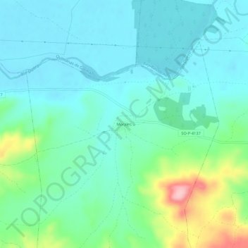
Name: Morales topographic map, elevation, terrain.
Location: Morales, Berlanga de Duero, Soria, Castile and León, Spain (41.45624 -2.95564 41.49624 -2.91564)
Average elevation: 920 m
Minimum elevation: 883 m
Maximum elevation: 1,046 m
Thank you for supporting this site ❤️
Make a donation
Make a donation
Gear up for your next adventure:
As an Amazon Associate, this site earns from qualifying purchases at no extra cost to you.