Geolocate

Retamas topographic map

Click on the map to display elevation.

About this map

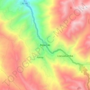
Name: Retamas topographic map, elevation, terrain.

Location: Retamas, Provincia de Pataz, La Libertad, Perú (-8.06277 -77.51525 -7.98277 -77.43525)

Average elevation: 3,587 m

Minimum elevation: 2,431 m

Maximum elevation: 4,570 m

Gear up for your next adventure:

🚲MTB Frame Bag - Carry tools and maps directly on your bicycle frame
🥾Mountain Hiking Shoes - Shoes with superior grip for mountainous terrain
🔋Emergency Crank Radio - Weather alerts and power without needing batteries
💧Filtered Water Bottle - Safe drinking water on the go
💧Collapsible Water Bottle - Space-saving water bottle for outdoor activities

As an Amazon Associate, this site earns from qualifying purchases at no extra cost to you.