
Thank you for supporting this site ❤️
Make a donation
Make a donation
Gear up for your next adventure:
As an Amazon Associate, this site earns from qualifying purchases at no extra cost to you.
Regalado topographic map
Click on the map to display elevation.
Thank you for supporting this site ❤️
Make a donation
Make a donation
Gear up for your next adventure:
As an Amazon Associate, this site earns from qualifying purchases at no extra cost to you.
About this map
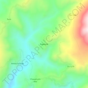
Name: Regalado topographic map, elevation, terrain.
Location: Regalado, Tumbaden, Province of San Pablo, Cajamarca, Peru (-6.98533 -78.69856 -6.94533 -78.65856)
Average elevation: 3,304 m
Minimum elevation: 3,043 m
Maximum elevation: 3,785 m
Thank you for supporting this site ❤️
Make a donation
Make a donation
Gear up for your next adventure:
As an Amazon Associate, this site earns from qualifying purchases at no extra cost to you.