
Thank you for supporting this site ❤️
Make a donation
Make a donation
Gear up for your next adventure:
As an Amazon Associate, this site earns from qualifying purchases at no extra cost to you.
Sordella topographic map
Click on the map to display elevation.
Thank you for supporting this site ❤️
Make a donation
Make a donation
Gear up for your next adventure:
As an Amazon Associate, this site earns from qualifying purchases at no extra cost to you.
About this map
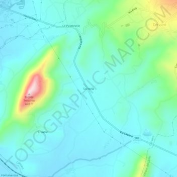
Name: Sordella topographic map, elevation, terrain.
Location: Sordella, Cervaro, Frosinone, Lazio, 03044, Italië (41.44662 13.86373 41.48662 13.90373)
Average elevation: 117 m
Minimum elevation: 44 m
Maximum elevation: 420 m
Thank you for supporting this site ❤️
Make a donation
Make a donation
Gear up for your next adventure:
As an Amazon Associate, this site earns from qualifying purchases at no extra cost to you.