
Thank you for supporting this site ❤️
Make a donation
Make a donation
Gear up for your next adventure:
As an Amazon Associate, this site earns from qualifying purchases at no extra cost to you.
Matarredonda topographic map
Click on the map to display elevation.
Thank you for supporting this site ❤️
Make a donation
Make a donation
Gear up for your next adventure:
As an Amazon Associate, this site earns from qualifying purchases at no extra cost to you.
About this map
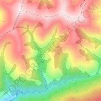
Name: Matarredonda topographic map, elevation, terrain.
Location: Matarredonda, Los Tojos, Cantabria, 39518, España (43.16089 -4.22440 43.18089 -4.20440)
Average elevation: 756 m
Minimum elevation: 438 m
Maximum elevation: 984 m
Thank you for supporting this site ❤️
Make a donation
Make a donation
Gear up for your next adventure:
As an Amazon Associate, this site earns from qualifying purchases at no extra cost to you.