
Thank you for supporting this site ❤️
Make a donation
Make a donation
Gear up for your next adventure:
As an Amazon Associate, this site earns from qualifying purchases at no extra cost to you.
Tulhas topographic map
Click on the map to display elevation.
Thank you for supporting this site ❤️
Make a donation
Make a donation
Gear up for your next adventure:
As an Amazon Associate, this site earns from qualifying purchases at no extra cost to you.
About this map
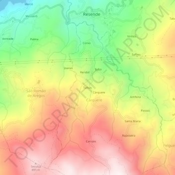
Name: Tulhas topographic map, elevation, terrain.
Location: Tulhas, Cárquere, Resende, Viseu, 4660-214, Portugal (41.06899 -7.98567 41.10899 -7.94567)
Average elevation: 508 m
Minimum elevation: 48 m
Maximum elevation: 927 m
Thank you for supporting this site ❤️
Make a donation
Make a donation
Gear up for your next adventure:
As an Amazon Associate, this site earns from qualifying purchases at no extra cost to you.