Geolocate

Duhatan topographic map

Click on the map to display elevation.

About this map

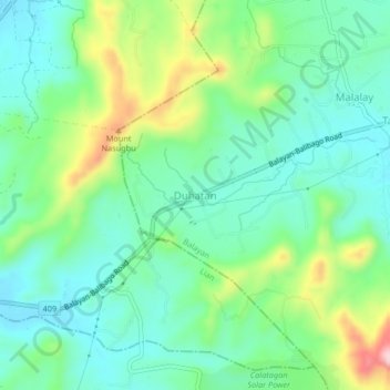
Name: Duhatan topographic map, elevation, terrain.

Location: Duhatan, Balayan, Batangas, Calabarzon, 4216, Philippines (13.92381 120.64083 13.96381 120.68083)

Average elevation: 81 m

Minimum elevation: 17 m

Maximum elevation: 236 m

Gear up for your next adventure:

🦶Anti-Blister Balm - Prevents friction and hotspots during long ascents
🎒Fully Waterproof Backpack - Total protection for photography gear and electronics
💧Filtered Water Bottle - Safe drinking water on the go
🥾Trail Running Boots - Durable shoes designed for trail running
💡LED Headlamp - Hands-free illumination for night hiking and camping

As an Amazon Associate, this site earns from qualifying purchases at no extra cost to you.