Geolocate

Pontedeva topographic map

Click on the map to display elevation.

About this map

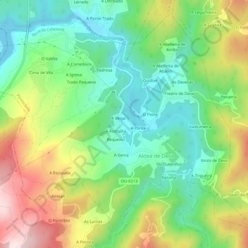
Name: Pontedeva topographic map, elevation, terrain.

Location: Pontedeva, Terra da Celanova, Ourense, Galicia, Spain (42.15021 -8.16633 42.18373 -8.11457)

Average elevation: 216 m

Minimum elevation: 69 m

Maximum elevation: 458 m

Gear up for your next adventure:

🧭GPS Tracker - Track your location in remote areas safely
🥾Trail Hiking Shoes - Durable shoes designed for rugged trails
🥾Approach Boots - Comfortable boots for hiking and climbing approaches
🧤Insulated Winter Gloves - Heavy-duty protection for sub-zero Canadian adventures
🧢Outdoor Visor - Breathable visor for sunny hikes

As an Amazon Associate, this site earns from qualifying purchases at no extra cost to you.