
Make a donation
Gear up for your next adventure:
As an Amazon Associate, this site earns from qualifying purchases at no extra cost to you.
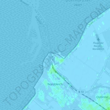
Norddeich topographic map
Click on the map to display elevation.
Make a donation
Gear up for your next adventure:
As an Amazon Associate, this site earns from qualifying purchases at no extra cost to you.
Norddeich
Norddeich liegt in der gemäßigten Klimazone, hauptsächlich im direkten Einfluss der Nordsee. Im Sommer sind die Tagestemperaturen tiefer, im Winter häufig höher als im weiteren Inland. Das Klima ist insgesamt von der mitteleuropäischen Westwindzone geprägt. Norddeich liegt an der Klimagrenze zwischen hohem Reiz-, Watt- und Küstenlandklima, womit der Aufenthalt im Ort für bestimmte Erkrankungen ein bedeutsamer Heilfaktor sein kann.
Make a donation
Gear up for your next adventure:
As an Amazon Associate, this site earns from qualifying purchases at no extra cost to you.
About this map
Name: Norddeich topographic map, elevation, terrain.
Location: Norddeich, Norden, Landkreis Aurich, Niedersachsen, Deutschland (53.60690 7.14875 53.64897 7.22275)
Average elevation: 0 m
Minimum elevation: -4 m
Maximum elevation: 5 m
Make a donation
Gear up for your next adventure:
As an Amazon Associate, this site earns from qualifying purchases at no extra cost to you.